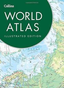
Collins World Atlas: Illustrated Edition
Dátum vydania: 01.01.2016
A paperback edition of this fully revised general reference atlas in the exciting Collins world atlas range. Highly detailed maps giving balanced worldwide coverage, beautifully illustrated thematic pages and thousands of facts and statistics.
This perfect family reference atlas provides a comprehensive and topical view of today’s world and the ...
Detaily o knihe
Počet strán: 240
Rozmer: mm
EAN: 9780008136628
Rok vydania: 2016
Žáner: Angličtina - beletrie
Typ: Paperback
Zákazníci, ktorí si kúpili túto knihu, si kúpili aj...
O knihe
A paperback edition of this fully revised general reference atlas in the exciting Collins world atlas range. Highly detailed maps giving balanced worldwide coverage, beautifully illustrated thematic pages and thousands of facts and statistics.
This perfect family reference atlas provides a comprehensive and topical view of today’s world and the issues facing it.
The contents include:
• Highly detailed reference maps, with beautifully illustrated thematic pages which include facts and tables plus a fully revised world statistics section with thousands of country statistics that enable the reader to learn more about the world.
• Highly illustrated thematic pages provide detailed information on, and interpretations of, major geographical themes and global issues.
• Over 150 pages of highly accurate and fully up-to-date maps with an index of over 50,000 place names (10,000 more than the nearest competitor at this price).
• Global issues including the environment, world conflict, population, climate change and the international drugs trade.
• Comparative satellite images show dramatic examples of environmental change e.g. deforestation.
• Highly detailed, updated regional and world-wide mapping.


